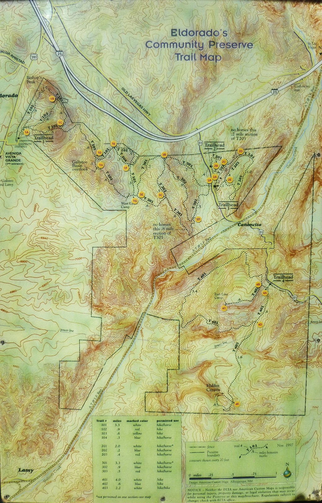
My wife and I live in Eldorado, New Mexico, just outside Santa Fe. We enjoy walking in the "Community Preserve", and along the "greenbelt" walking/biking trails and paths.
Maps of all these trails and paths are very nice to have.
I found a a PDF map of the greenbelt paths here: Eldorado's Greenbelt and Bike Path Map.
However, I just discovered that finding an online version of the Community Preserve Trails map is next to impossible (I never found one). Who woulda thunk it.
So I decided to create this very small blog, and insert a picture of the Community Preserve Trails Map.
This picture was taken on January 21st, 2014. For all I know the map might have been out of date on the day I took the picture, and of course, changes to the trails might have been made since then as well, so please, use this picture of the map at your own risk.
To zoom in and see details better...on a PC, right-click on the image, click SAVE AS (or similar), then open the picture file in whatever image viewing software you have. Mac is probably similar.
Enjoy!
